Dangerous Multi-day Severe Weather Threat Targets Central U.S. Into Early Next Week

A widespread severe weather outbreak is expected to unfold across parts of the central United States over the next several days, bringing the threat of tornadoes, damaging winds, large hail, and flooding rain from the Plains into the Midwest. Forecasters warn the most dangerous conditions are likely to develop Sunday and Monday as a powerful storm system moves across the region.
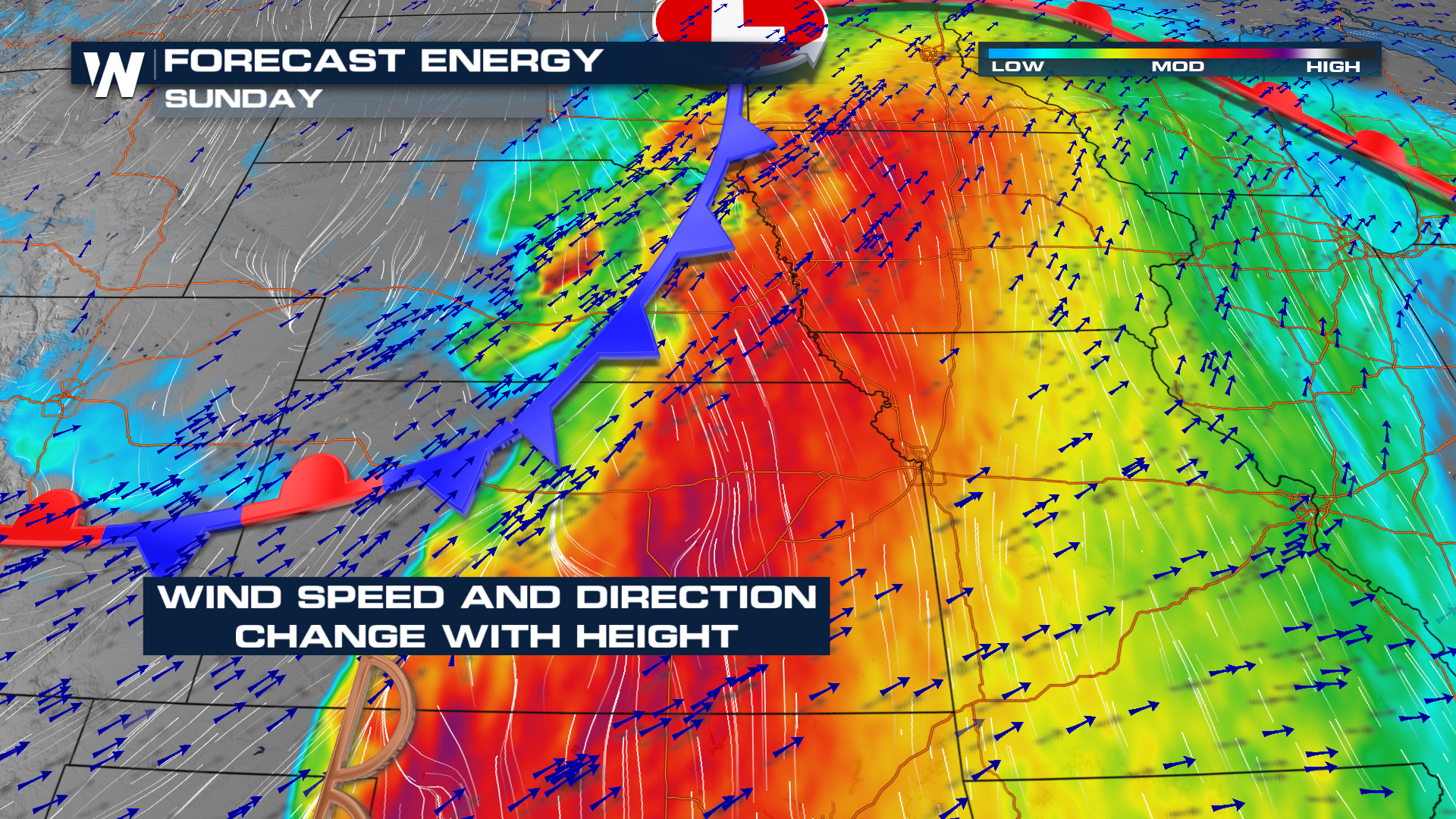
Another strong upper-level trough will be dropping across the Great Plains on Sunday and Monday. Model data continues to hint at stronger ingredients coming together, including instability and wind shear. Sunday, moderate to high instability will be building in. Southwesterly winds aloft and southerly winds at the surface will enhance wind shear, and changing wind direction with height would increase the tornado threat.
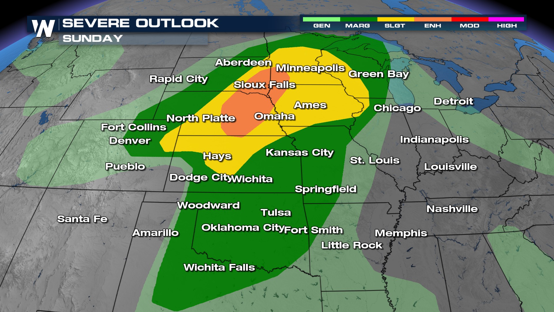
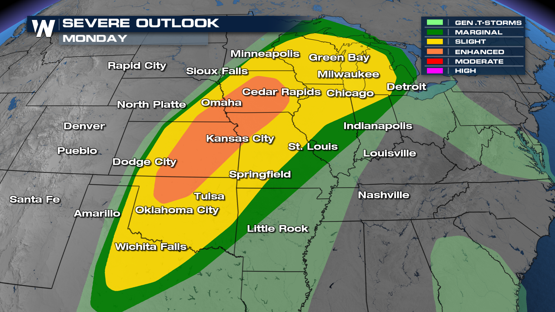
Severe Outlooks
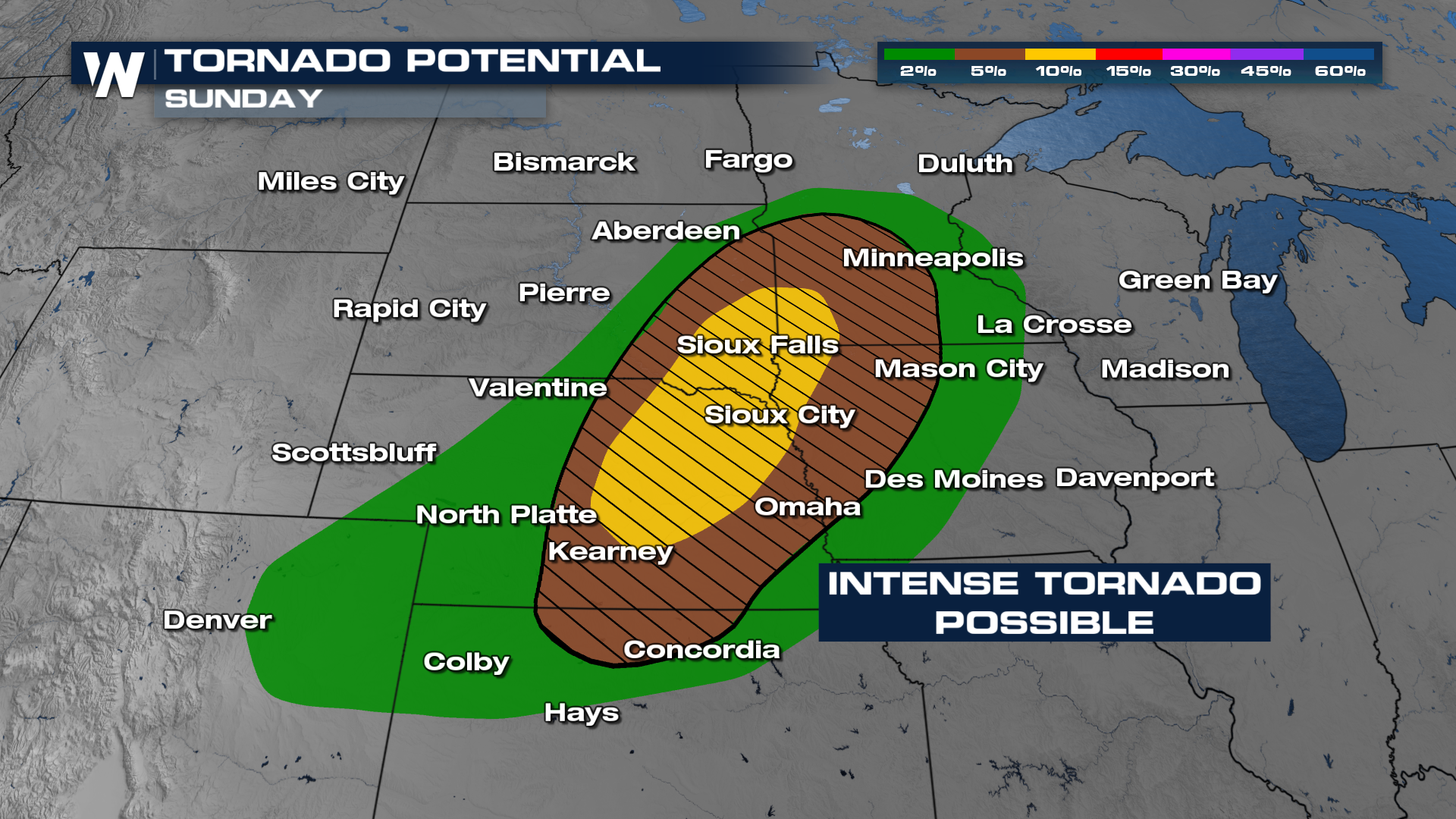
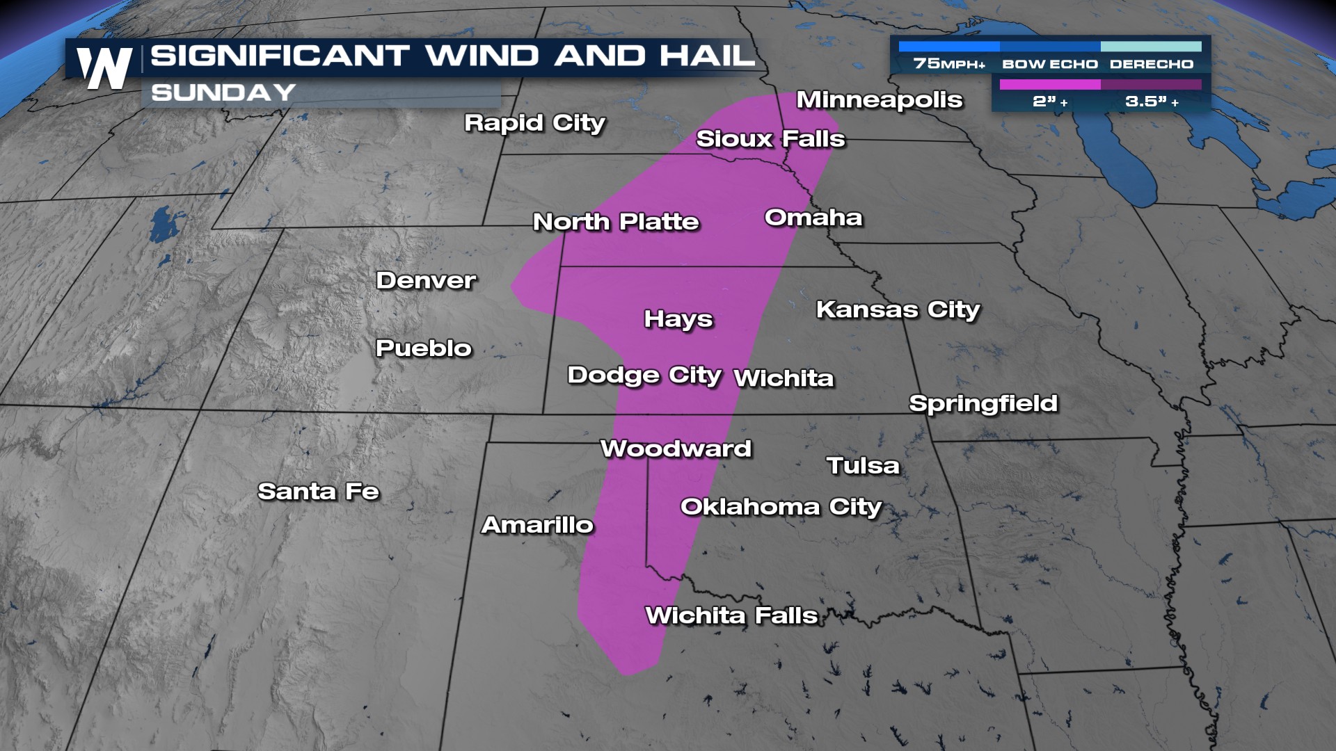
Sunday, atmospheric conditions are expected to become even more favorable for dangerous storms to develop across parts of the northern and central Plains. SPC has highlighted an Enhanced Risk for Sunday and Monday across the Central Plains as all modes of severe weather will be possible, including strong tornadoes, very large hail, and destructive damaging winds, especially in areas stretching from Nebraska into South Dakota, Minnesota, and Iowa. In addition to the tornado threat, widespread damaging winds and large hail could impact several communities.
The severe weather risk is expected to peak on Monday as the storm system pushes farther east. A large portion of the central U.S. could face dangerous thunderstorms, including areas from Texas and Oklahoma northward into Iowa and Wisconsin. Major cities such as Dallas, Oklahoma City, Kansas City, Omaha, Chicago, and Minneapolis could experience strong to severe storms. Some storms may become capable of producing long-track tornadoes and widespread wind damage.
Forecast
On Sunday, storms will still linger along a warm front across Nebraska and Iowa. By the afternoon and early evening hours, supercells are expected to develop near the cold front, which could lead to all severe weather hazards. Into the overnight hours, storms will congeal into a complex that will promote damaging winds. Monday will be similar to Sunday with all hazards, but damaging winds will overwhelmingly become the biggest hazard into the evening and overnight hours.
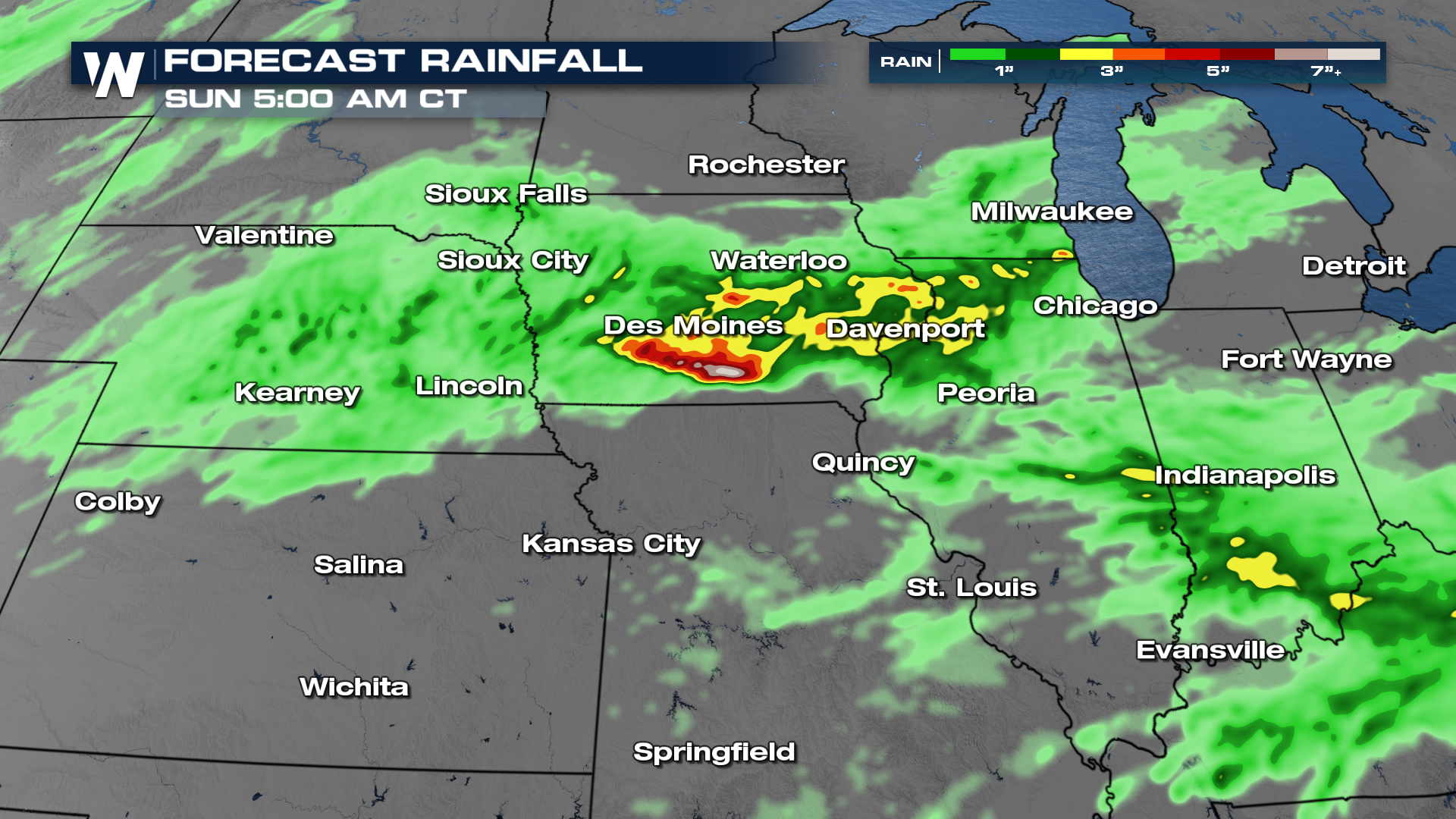
Heavy rainfall will also be a growing concern throughout the event. Repeated rounds of thunderstorms may lead to flash flooding in low-lying and flood-prone areas, especially where storms track over the same locations. Rainfall totals could add up quickly across parts of the Plains and Midwest before the system finally shifts eastward by the middle of next week.
Tune into WeatherNation for more details.


